About Luka Petrčane
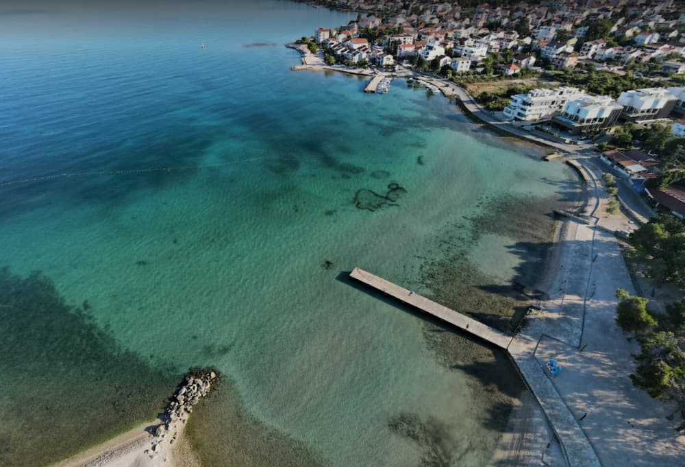
Port of Petrčane port basin 1 Longitude: 15° 12'44.9 "E Latitude: 44° 08'24.1 "N Port of Petrčane / port basin 1 covers 8,201 m 2 of which the land area is 891 m 2 and the sea area is 7,310 m 2. Port of Zadar Petrčane / port pool 1 is entirely intended for communal connection. Port of Petrčane / port basin 2 Longitude: 15° 09'24.9 "E Latitude: 44° 11'16.3 "N Port of Petrčane / port basin 2 covers 6,306 m 2, of which the land area is 665 m 2 and the sea area is 5,641 m 2. The port of Petrčane / port basin 2 is entirely intended for communal connection. Port of Petrčane / port basin 3 Longitude: 15° 09'38.9 "E Latitude: 44° 11'08.4 "N Port of Petrčane / port basin 3 covers 33,227 m 2, of which the land area is 3,848 m 2 and the sea area is 29,379 m 2. The port of Petrčane / port basin 3 is entirely intended for communal connection. Port of Petrčane / port basin 4 Longitude: 15° 09'43.5 "E Latitude: 44° 10'38.0 "N Port of Petrčane / port basin 4 covers 8,861 m 2, of which the land area is 1,028 m 2 and the sea area is 7,833 m 2. The port of Petrčane / port basin 4 is entirely intended for communal connection.

Facilities
Port Information
Telephone
Berth Sizes
Depth at MLW
Manoeuvrability
Channel Marking
Overseas Visitor Berths
Dock Type
Style Stern To
Tidal Flow
Weather Forecast
 NE 5–12 knots.
 21 to 24°C
 Calm sea
 UV Index: 0 - Low
 Mostly fine
- NE 10 knots decreasing to 6 knots.
- Increasing from 24 to 28°C
- Calm sea
- UV Index: 7 - High
- Mostly fine
- NW 3–13 knots.
- 25 to 30°C
- Calm sea
- UV Index: 7 - High
- Partly cloudy