Our Comprehensive Guide to Nautical Vocabulary

The Ultimate Glossary of Maritime Terms

Browse all
local knowledge on phone
Term of the day

Map

Map

A map is a visual representation of an area, highlighting relationships between elements of that space such as objects, regions, and themes. In the context of maritime navigation, maps are crucial tools for sailors and maritime users, providing essential information for safe and efficient travel across bodies of water.

Maritime maps, often referred to as nautical charts, are specifically designed to meet the needs of sailors. These charts include detailed information about coastlines, water depths, navigational hazards, locations of ports and harbors, and other critical data necessary for navigation. They are indispensable for plotting courses, avoiding dangers, and ensuring safe passage.

Nautical charts are typically created and updated by national hydrographic offices and are available in both paper and digital formats. Digital charts, known as Electronic Navigational Charts (ENCs), are increasingly popular due to their ease of use and ability to be updated in real-time.

In addition to physical features, maritime maps may also include information on tides, currents, and weather patterns, which are vital for planning voyages and ensuring the safety of vessels at sea. Understanding how to read and interpret these maps is a fundamental skill for any sailor.

Read More
local knowledge on phone

Download the App for accurate weather forecasts.

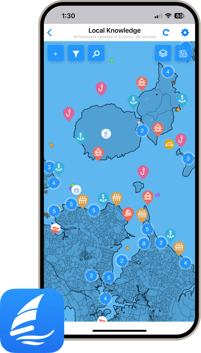
Download the PredictWind App for world-leading weather forecasts and info on your next destination including marine locations, amenities, activities, attractions, local hazards and more.