About Club Nautic e.V.
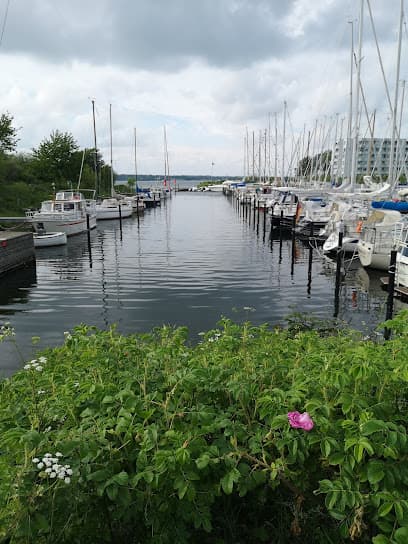
Club Nautic e.V.. is a guarded yacht club with a sheltered harbour in an agriculturally attractive location. The port can be safely entered day and night, with two high-rise buildings to the north serving as daytime orientation aids and primary lighting at night. ⚓ Harbour Facilities Total moorings: 169 Free moorings marked with green signs Entrance marked with control/driving light at 121° ⚓ Services & Amenities Guarded marina Sheltered harbour Easy daytime and nighttime access


Facilities
COORDINATES
54.85831 N, 9.57153 E
Port Information
Telephone
Berth Sizes
< 10m
Depth at MLW
2 - 3m
Manoeuvrability
Fair
Channel Marking
Fair
Port of Entry
No
Overseas Visitor Berths
Yes
Dock Type
Floating
Tidal Flow
Negligible
Weather Forecast
Tue
5AM - 9AM
21 July 2026
 NW 5–7 knots.
 Increasing from 10 to 17°C
 UV Index: 0 - Low
 Sunny
Sunny
Tue
9AM - 1PM
21 July 2026
- NW 6 knots increasing to 9 knots.
- Increasing from 17 to 23°C
- UV Index: 5 - Moderate
- Sunny
Tue
1PM - 5PM
21 July 2026
- W 10 knots increasing to 15 knots. Gusts up to 21 knots.
- 21 to 26°C
- UV Index: 5 - Moderate
- Sunny